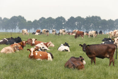
US dairy co-op measuring pasture with satellite imagery
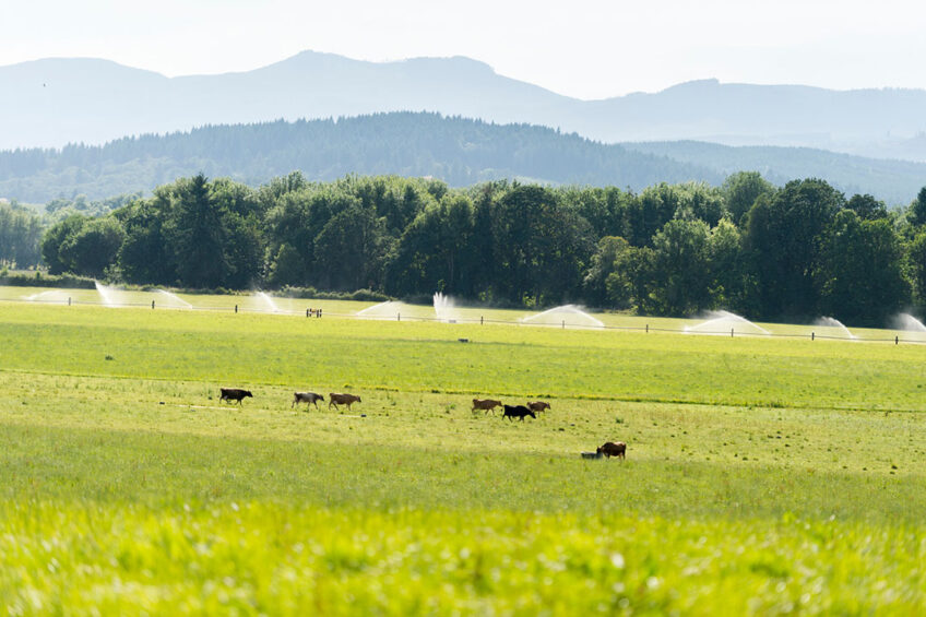
A growing global population requires that farmers be ever more resourceful and efficient with the tools at their disposal. Feed efficiency – especially when it comes to pasture and forage – is a prime example of this for dairy farmers. A US dairy co-op is launching a pilot programme measuring pasture with satellite imagery.
One leading US organic dairy co-operatives, Organic Valley, has plans to utilise advanced satellite technology that will provide detailed data and information so their producers can maximise their intensive grazing programs. Altogether, farmers belonging to Organic Valley manage nearly 200,000 acres of pasture.

This year, 22 dairies are participating in a pilot programme utilising satellite imagery. According to Wade Miller, Organic Valley’s senior director of farm resources, they intend to make this programme available to all their farmers on a voluntary basis in 2022.
The inspiration is that (excellent at) pasture and rotational grazing has been a core of our cooperative for a long time,” says Miller. “Our farmers are heavily committed to it.”
The power of data
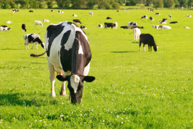
For this pilot programme, satellite photography will gather metrics on forage growth. In the US, certified organic dairies by the Department of Agriculture must receive at least 30% of their total dry matter intake from pasture, making intensive management crucial to success.
With this in mind, Organic Valley took note of how different precision agriculture equipment is able to collect and interpret different types of crop and field data simply by evaluating satellite imagery. Miller explains they noticed this technology had not yet been used in a pasture management setting, and they realised there was a huge opportunity.
Increase pasture use: Steps to success
Here we dive into the latest findings on how to increase use of pasture and explore and face the challenges that come with it – while protecting milk quantity and quality. We hear from experts around the world. Read more…
This idea was discussed with their farmer membership, and the decision was made to invest in building a computer model that could take satellite images and tell farmers exactly how much forage is available in their pastures at any given time and where specifically that was.
Then you could use that information to manage your pastures better to get more and get higher quality feed off your pastures,” Miller says, noting their farmers were happy to fund the project.
A third-party company is taking the photos and assisting the Organic Valley team to build the computer logarithm. Now, this pilot programme will put that work to the test and make any necessary changes.
“Our work is to make sure that what the satellite is telling us is the same thing the farmers are measuring,” Miller continues. “And that’s what this pilot is about – making sure we’re getting it right.”

The logarithm’s job is to take the images to measure the chlorophyll present in the plants which indicates the level of growth. The farmers receive a detailed map of their pastures on a weekly basis with the interpreted information. Then they physically measure the biomass present in their paddocks throughout the grazing season for the rest of the team to evaluate and check for accuracy.
Miller is optimistic their system is accurate but will need to physically measure the biomass through these pilot programmes to be certain. He says that once completed, their system will not only be able to show the varying degrees of pasture growth, but also be able to report to farmers the amount of tonnage in each pasture.
“We will also include what we call a grazing wedge, which would be the biomass range where the feed would be of optimum quality and optimum quantity,” he says, “Farmers will look at those graphs and pictures and try to time their pasture rotation and their management to keep their cows on paddocks that are in the optimum range.”
Dairy farming and partnering with AI systems
Discerning accurate information about artificial intelligence in agriculture is very important, as is an examination of actual uses. Find out more…
Positive environmental impacts
This programme comes at an optimal time now that the US is becoming heavily invested in grassland management for carbon storage purposes. With a goal of having net-zero carbon emissions by the year 2050, the government is discussing ways to incentivise farmers who manage their land to optimally store carbon in the soil.
Other benefits of well-managed pastures include reducing soil erosion which protects water quality, Miller notes.
“Now the world is really starting to focus on the science (of pasture management) and trying to determine, is it a carbon sink? If it is, how much of a carbon sink? Does it lower the carbon footprint of a dairy?” he says.
We believe pasture is the most singular, positive impact we can make on the earth’s resources.”
Of course, better pasture management is also a powerful tool to help farmers get the most feed efficiency for their animals. How much pasture is utilised or wasted varies widely on forage type and grazing habits. However, rotation grazing is one of the best tools to avoid wastage as it forces animals to graze available forages in a particular location.
Looking to the future
Moving ahead, Miller says that they are open to other ways this technology might be able to be adapted to further benefit their farmers.

“Instead of walking the acres of our paddocks daily,” says Jon Bansen, one of the co-op’s dairy farmers from Monmouth, Oregon, “we can rely on the imagery. This means we have more time for other things around the farm like animal care and other projects.”
Another exciting component of their pilot programme is the further exploration regarding the science of biomass measurement and how healthier pastures support healthier ecosystems and soil.
This type of research is labour-intensive and requires lots of repetitive soil testing, Miller explains. However, if their pilot is successful, satellite technology may be able to play a big role in this type of research.

Bansen agrees, saying that working with nature is an important part of how they operate.
“Pasture excellence is a cornerstone of our cooperative and maximising pasture improves both farm ecosystems and profitability,” he says. “By maximising pasture efficiency, we’re also regenerating the soil and sequestering carbon to improve the land for the next generation.”